JASPER – The evacuation of thousands of residents and tourists from the Jasper townsite, which is threatened by destructive wildfires, is now complete.
However, Parks Canada officials say evacuation of hikers in the backcountry of Canada’s 10th largest national park is ongoing. All Parks Canada staff who are not responding to wildfires have also been evacuated.
Parks Canada estimates between 20,000 and 25,000 have been forced to flee the community, save for about 40 people who have refused to leave despite the evacuation order.
“Our priority is to protect the town and community of Jasper, limiting wildfire growth towards the town, Highway 16, and critical infrastructure,” states a social media post from Parks Canada.
"Jasper National Park and the Town of Jasper have mobilized all available resources, with federal, provincial, and municipal agencies all dedicated to supporting firefighting and protecting the town.”
Structural protection crews and specialists are installing sprinklers and hose lines to protect homes and hotels throughout the community.
Another high-volume water system is being established at the southwest perimeter of the town.
“We continue to import additional firefighting resources,” states Parks Canada.
Firefighting efforts include aerial suppression with multiple aircraft and airtankers.
Parks Canada says there are also plans to set up control lines using heavy equipment and dozers.
“CN is assisting with their specialized train water tank along the rail line,” states Parks Canada.
“We continue to monitor the wildfire from the air and with satellite imagery and have roving personnel on watch throughout the night.”
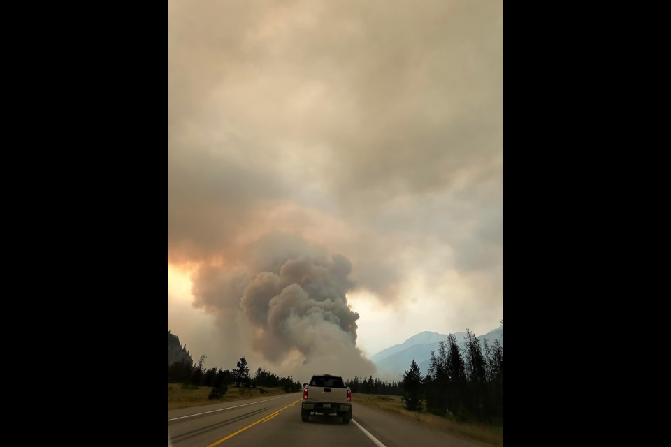
The wildfire threatening the townsite from the north is located about nine kilometres away and between the transfer station and the Jasper airstrip. It has burned an estimated 270 hectares along both sides of Highway 16.
The wildfire approaching from the south, which is located approximately 15 kms away, has burned about 6,750 ha. The south end of the wildfire is near Kerkeslin campground. It follows the Icefields Parkway, also known as Highway 93, north to near Horseshoe Lake.
The wildfire crosses the highway a few km south of Wabasso campground. The northeast extent of the fire is near Wabasso Lake.
“We will keep the public informed about wildfire activity and our firefighting response as more information becomes available,” states Parks Canada.
“This is a dynamic and evolving situation.”
Evacuation order
Parks Canada says residents and visitors have been inquiring about returning to Jasper to collect personal items, documents, and assets.
“At this time, returning to Jasper is not possible,” states Parks Canada.
“The Town of Jasper and Jasper National Park remain closed, and it is crucial to comply with the evacuation order. Our top priority is the safety of our staff, residents, and visitors.”
For those who have evacuated safely, register as an evacuee. If you have an Alberta Digital ID, use this link: https://emergencyregistration.alberta.ca/.
If you do not have a My Alberta Digital ID, you can register in-person at a Reception Centre in Grande Prairie and Calgary.


