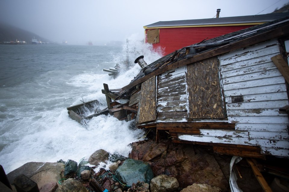
ST. JOHN'S, N.L. — Massive waves slammed Newfoundland and Labrador's coastline on Sunday, as a powerful winter storm left thousands without power, tore down trees and house siding and sent small buildings tumbling into the ocean.
Ian Gillies, reached over the phone from Brigus South — a community along the coast about 60 kilometres south of St. John’s — says he was blown away by the rough waters and pounding waves.
“We've been here about 14 years and this is by far the highest surf we've seen,” he said in an interview Sunday.
“The waves crashed over the breakwater. And an island where normally people walk out to, that I would say is 20 or 30 feet above sea level, it had waves crashing over that as well.”
Large rocks are being swept on to land, covering some roadways.
“The plows that are normally doing snow, they're pushing rocks off the streets,” Gillies said.
Rob Carroll, an Environment Canada meteorologist stationed out of Gander, N.L., said the "very powerful" low pressure system that made its way through the region brought wind speeds between 100 and 120 kilometres an hour in many areas, and as high as 135 kilometres an hour on the Bonavista Peninsula.
Along with the wind, the coastline has been hit with "some very high waves, pounding surf crashing into eastern and northeastern Newfoundland," Carroll said.
"We've seen little buildings right along the coast that have been pulled into the water or flooded, some water coming up over roadways, pushing a lot of rocks across some roadways along the shore... a lot of downed trees, some shingles and siding ripped off houses," he said, adding that the extent of the damage will become clearer in the next 24 hours.
Pictures and videos on social media show flooding in the St. John’s area, wind damage to the facade of a downtown pub, debris and rocks that have been washed up on land and waves pounding the coastline.
As of 5 p.m. local time Sunday, more than 8,000 Newfoundland Power customers were in the dark.
Environment Canada has issued weather warnings for the majority of Newfoundland and parts of Labrador, with messy weather forecast through the day into Monday morning.
Western Newfoundland was expected to see around 10 centimetres of snow along with 80 kilometre-an-hour winds, which could result in poor driving conditions and low visibility on roads.
Similarly, poor visibility was expected in the area surrounding Port aux Basques, where up to 15 centimetres of snow was expected along with 100 kilometre-an-hour winds.
In the St. John's area, the weather agency called for rainfall between 20 and 40 millimetres which could result in localized flooding in low-lying areas.
In eastern and northeastern Newfoundland, Environment Canada warned of wind gusts between 90 and 120 kilometres an hour, which the weather agency warns could cause damage to roof shingles and windows.
This report by The Canadian Press was first published Jan. 5, 2025.
-- by Lyndsay Armstrong in Halifax
The Canadian Press


